Main pageAbout this DVDDataVisualQueryReferences


References

Flood Chronology | Websites | Synoptic Charts | Raingauge Locations

Floods in NRMs | Flood Coordinates | Catchment Graphic


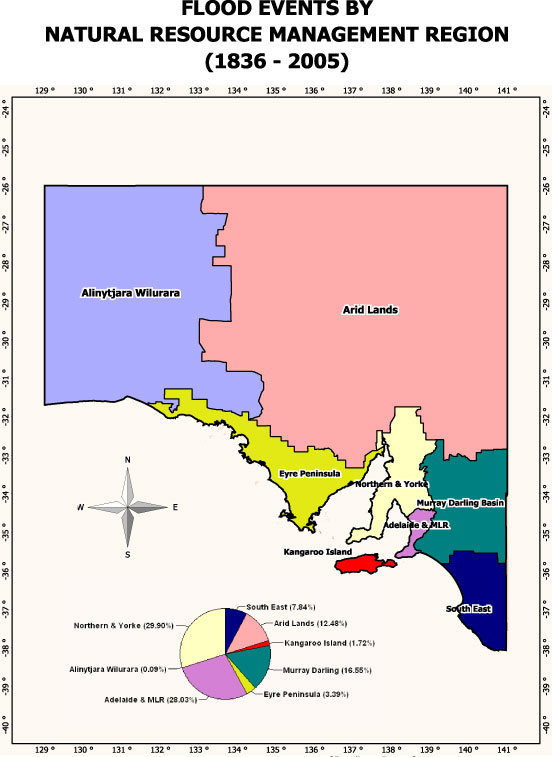
Floods in Natural Resource Management Regions (NRM)

Alinytjara WiluraraArid LandsEyre PeninsulaNorthern & YorkeAdelaide & Mt Lofty RangesMurray Darling BasinSouth EastKangaroo IslandNRMs in South Australia

click each region for region detail


Google Earth Links:

Google Earth will display satellite images of each of the following NRM regions if Google Earth is installed on your computer. If you need to install this software, click here


Percentage of Overall Flood Events by NRMs